
Contractors
Drone-based 3D models allow for quick data acquisition of aerial imagery, making it feasible for frequent missions (ie: monthly or quarterly) for up-to-date site analysis of as-builts. Every measurement you need is at your fingertips with cm accuracy, for current and past models, giving you access to historical data and documenting work progress. Reduce material, labor, and project costs, estimate stockpile volumes, measure areas or distances, and detect errors before they become delays, thereby increasing productivity and shortening timelines to completion.
With an optional 360 ground tour, you can give stakeholders a panoramic view of the site from key locations. With Photogrammetry, you can quickly visualize the space and move about it to inspect, plan, estimate, or explore the area from a computer, tablet or smart phone.
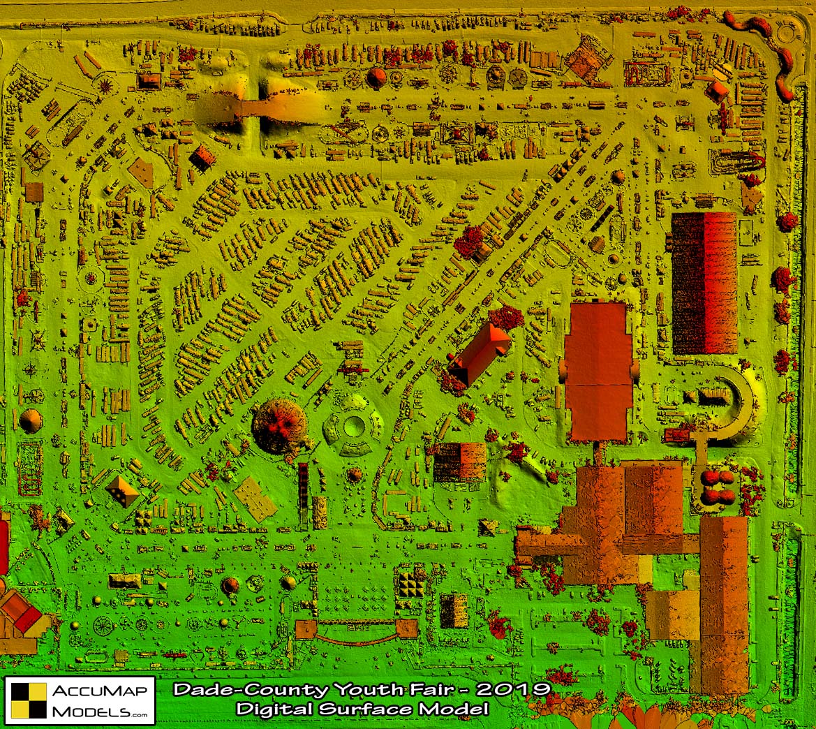
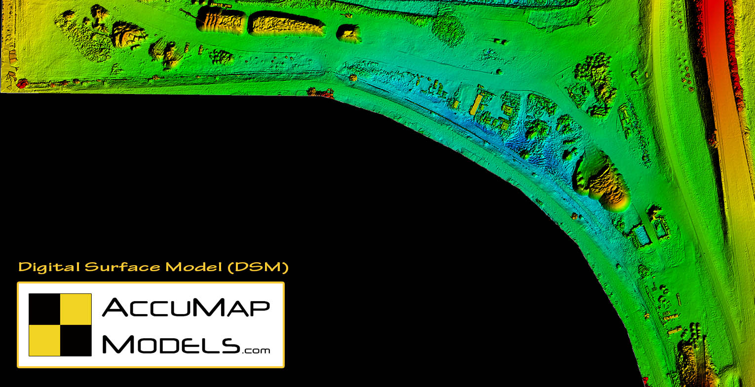
Digital Surface Models (DSM)
A DSM allows you to see the scene in a colorful way, each color representing a variation in elevation. The warmer orange-to-red represents higher elevations, with the cooler green-to-blues representing lower elevations.
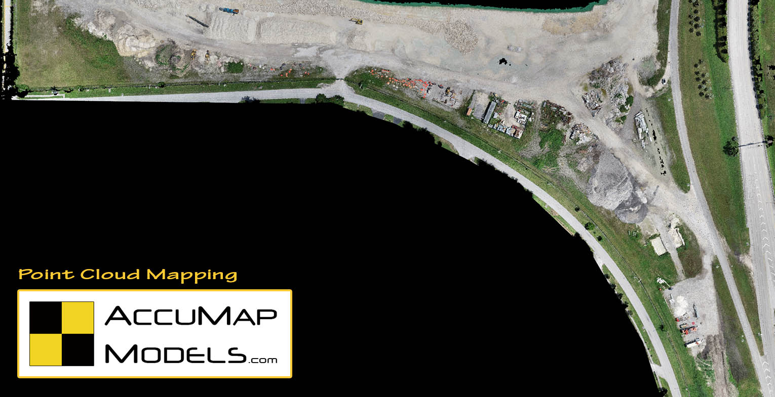
Point Cloud
A point cloud is essentially a 3D model of the scene, created from thousands of overlapping pixels. You can click any pixel within the point cloud, and obtain its X,Y,Z coordinates.
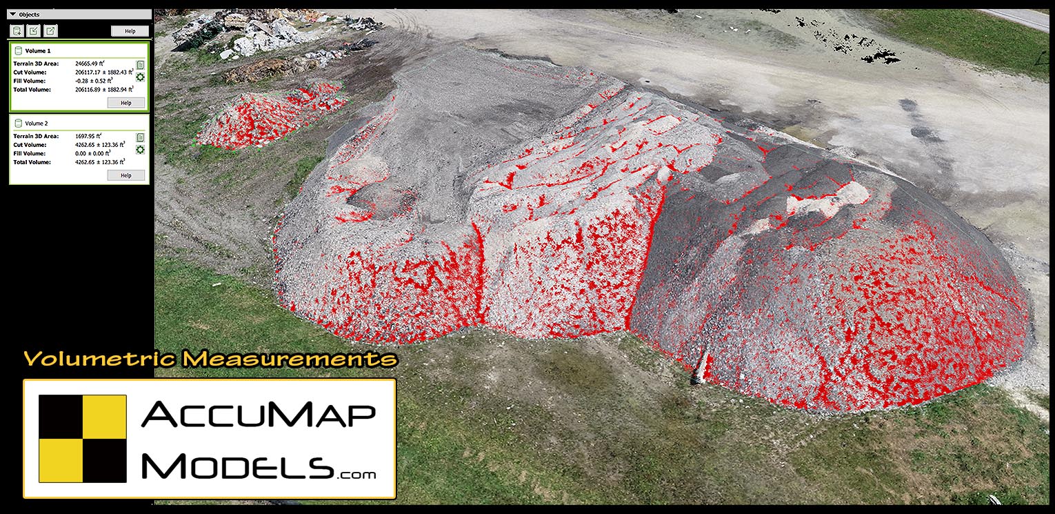
Volumetric Measurements
With the volumetric feature, a stockpile of sand, gravel, logs, or debris, can be calculated for volume measurement. This can be done quickly, safely, and with great accuracy.
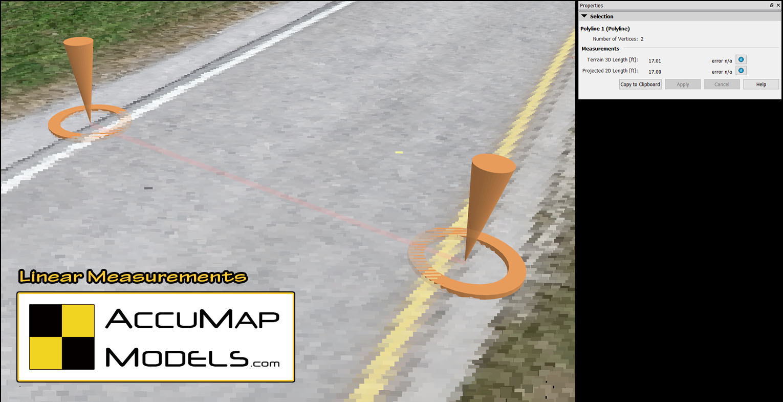
Linear or Spacial Measurements
This feature allows us to measure any two points, or a flat spacial area within a scene to obtain linear or spacial measurements. By measuring within the point cloud model, you can select pixel accurate points for better measurements.
3D Model samples
More Samples
Pix4D Cloud sample – FL Turnpike Construction
Use the link below to access the Pix4D construction model and test the measurement features by clicking 3D (bottom left) and using the measuring buttons on the top, right (online test model only, elevations are not accurate):
https://cloud.pix4d.com/pro/project/478048/map?shareToken=addc226d-0b21-49b2-88e2-54ea95b7fda3